
Map view
Beartooth Highway
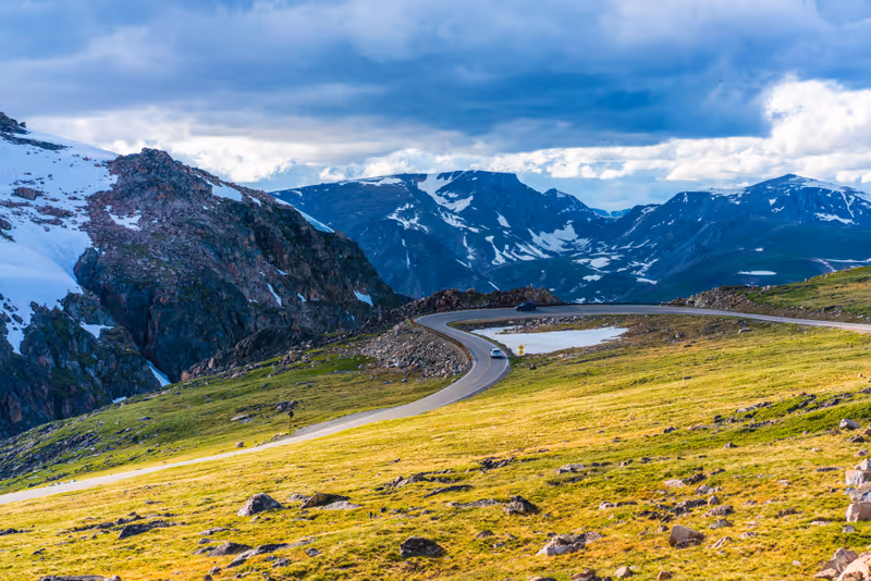
- Beartooth Highway is a scenic byway located along U.S. Route 212, connecting the towns of Red Lodge, Montana, and Cooke City, Montana
- The 68-mile stretch is famous for its winding roads, hairpin turns, and panoramic vistas of the Absaroka and Beartooth Mountains
- It reaches an elevation of over 10,000 feet at Beartooth Pass, offering views of the surrounding wilderness
- Originally constructed to facilitate mining operations, it now serves primarily as a route to Yellowstone National Park
Big Sky Resort
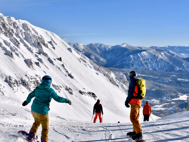
- Big Sky Resort is a prominent ski resort located in Big Sky, renowned for its extensive skiable terrain, which range from groomed trails to challenging descents
- It is one of the largest ski resorts in North America
- In addition to winter sports, Big Sky offers summer activities such as mountain biking, hiking, golfing, and zipline tours
- The resort is set against the backdrop of the Greater Yellowstone Region, providing a picturesque environment for outdoor activities
#18 in Best Ski Resorts in the World
#11 in Best Ski Resorts in the USA
Museum of the Rockies, Bozeman
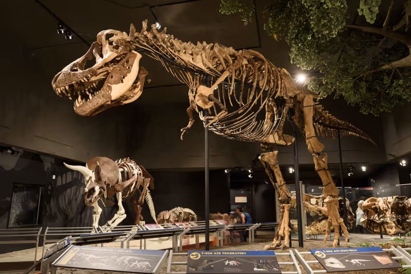
- The Museum of the Rockies is a cultural and natural history museum located in Bozeman
- The museum is particularly renowned for its extensive paleontological collections, housing the largest collection of North American dinosaur fossils in the United States
- The museum also includes a planetarium that offers programs related to astronomy
Little Bighorn Battlefield National Monument, Crow Agency
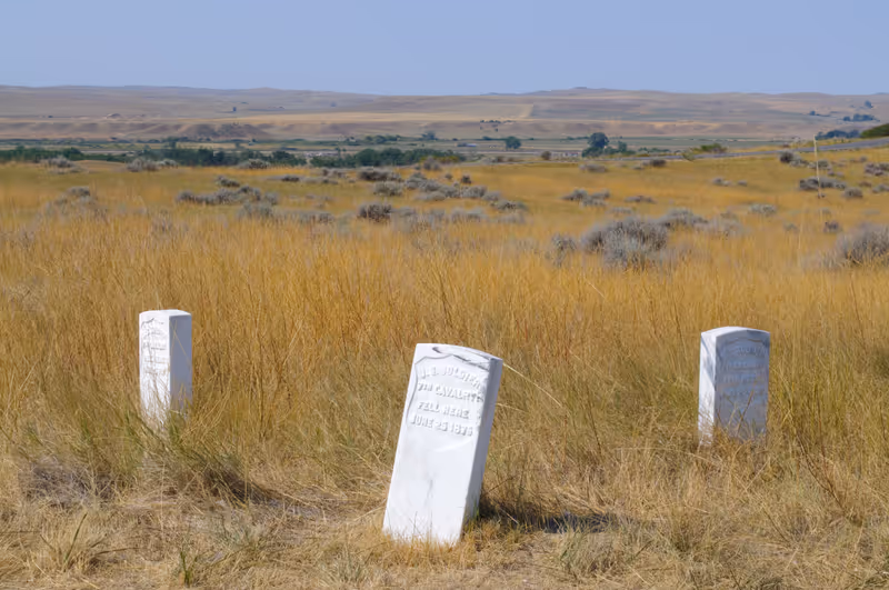
- Little Bighorn Battlefield National Monument is a historical site located near Crow Agency
- It commemorates the Battle of the Little Bighorn, which took place on June 25 and 26, 1876
- The battle was fought between the U.S. Army's 7th Cavalry, led by Lieutenant Colonel George Custer, and a coalition of Lakota, Cheyenne, and Arapaho warriors
- The conflict arose as a result of U.S. policies that threatened the traditional way of life of these Native American tribes
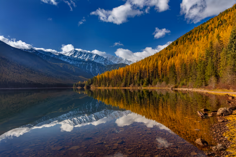
Lake McDonald, Glacier National Park
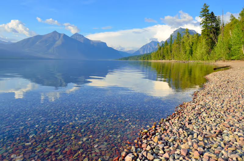
Best time to visit: July-Aug
- Lake McDonald is the largest lake in Glacier National Park, formed as a result of glacial carving during the Ice Ages, which shaped the landscape of the park
- The lake is known for its striking Arctic blue and green waters, and is a popular destination for kayaking and fishing
Hidden Lake Overlook, Glacier National Park
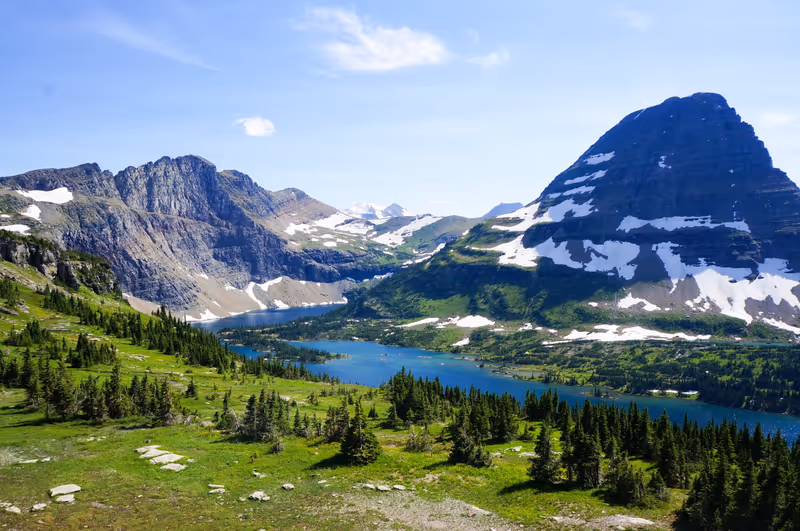
Walk difficulty: moderate
Best time to visit: July-Aug
- Hidden Lake Overlook is a scenic viewpoint located in Glacier National Park
- The trail provides panoramic views of Hidden Lake, which is surrounded by majestic mountains, including Bearhat Mountain and the rugged ridgeline of Reynolds Mountain
- Hikers can enjoy diverse landscapes, including alpine meadows and open grasslands
Logan Pass, Glacier National Park
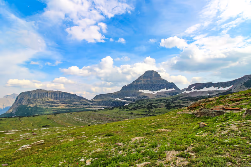
Best time to visit: July-Aug
- Logan Pass is a prominent feature in Glacier National Park, and stands at an elevation of 6,646 feet (2,026 meters), making it the highest point accessible by car in the park
- Situated along the Continental Divide, Logan Pass is a crucial point on the Going-to-the-Sun Road, which connects the park's eastern and western entrances
- The area is popular for hiking, with several trails offering viewpoints and opportunities to see wildlife
Iceberg Lake, Glacier National Park
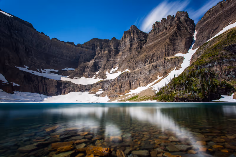
Walk difficulty: moderate
Best time to visit: July-Aug
- Iceberg Lake is a stunning glacial lake located in Glacier National Park
- It is situated in a bowl-like valley surrounded by mountains, notably Mount Wilbur and Iceberg Peak
- The lake is known for its cold waters, which often contain icebergs, due to its location in a shaded area that receives little sunlight
St. Mary and Virginia Falls Trail, Glacier National Park
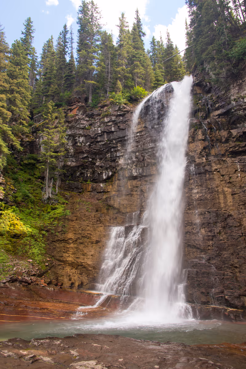
Walk difficulty: moderate
Best time to visit: July-Aug
- The St. Mary and Virginia Falls Trail is a scenic hiking route located in Glacier National Park
- The trail crosses the St. Mary's River and runs parallel to Virginia Creek, where hikers can enjoy views of two waterfalls: St. Mary Falls and Virginia Falls, the latter of which is known for its multi-tiered drops
Trail of the Cedars, Glacier National Park
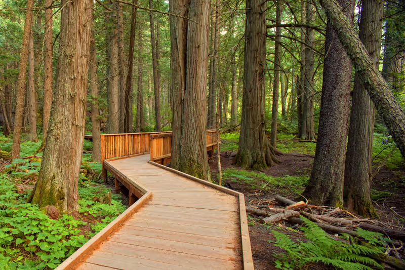
Walk difficulty: easy
Best time to visit: July-Aug
- The Trail of the Cedars is a hiking trail located in Glacier National Park, that winds through a lush forest filled with towering red cedar and black cottonwood trees, some of which are estimated to be over 500 years old
- The area is known for its views of Avalanche Creek, and continues towards Avalanche Lake, which can be reached after an additional hike
#19 in Best Easy Hikes in the USA
Avalanche Lake, Glacier National Park
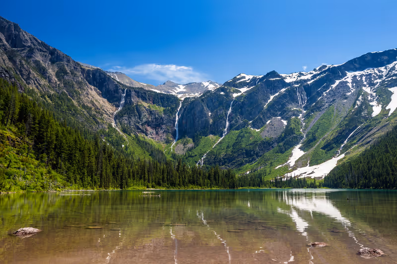
Walk difficulty: moderate
Best time to visit: July-Aug
- Avalanche Lake is a natural feature located in Glacier National Park, where a trail leads to an alpine lake surrounded by towering mountains, including views of Bearhat Mountain
- Beginning at the Trail of the Cedars Trailhead, the area is known for its waterfalls and opportunities to view abundant wildlife, such as bears
Garnet Ghost Town
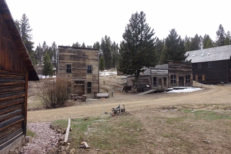
- Garnet is a historic ghost town located in Granite County, at an elevation of approximately 6,000 feet
- It was once a thriving mining community during the 1890s, with a population peaking at around 1,000 residents as they sought gold in the surrounding mountains
- The town largely declined by the early 1910s when the gold resources were depleted
- Named after the semi-precious garnet stones found in the area, Garnet was a well-established town with many families living there, which was somewhat unusual for mining camps of that era
- Today, Garnet is recognized as one of Montana's best-preserved ghost towns, featuring numerous historical buildings and structures that date back over a century
Flathead Lake
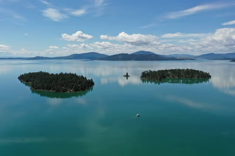
- Flathead Lake is the largest natural freshwater lake in the western United States
- It covers over 200 square miles, is renowned for its clarity, and is considered one of the cleanest lakes in the world
- Flathead Lake is also notable for its recreational opportunities, including fishing, boating, and exploring the Flathead Lake Marine Trail, which features various stopping points around the lake
Going-to-the-Sun Road, West Glacier
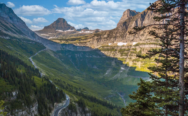
- Going-to-the-Sun Road is a scenic mountain road located in Glacier National Park, that spans approximately 50 miles (about 80 kilometers)
- The road connects the West Entrance of the park to the St. Mary Entrance, crossing the Continental Divide at Logan Pass, which reaches an elevation of 6,646 feet (2,025 meters)
- The drive offers views of glaciers, valleys, and waterfalls
- Completed in 1933, it is considered an engineering marvel due to its construction through challenging terrain, including sheer cliffs and heavy snowfall
- There are numerous stopping points along the road where visitors can enjoy the scenery, take photographs, and access hiking trails
Flathead National Forest
- Flathead National Forest is a vast national forest located in the Rocky Mountains, situated just south of the Canadian border and adjacent to Glacier National Park
- The forest primarily lies within Flathead County and is known for its diverse ecosystems, including mountainous terrain, lakes, and wildlife habitats, making it a popular destination for hiking and camping